Spring 2025 Utah, 4.16.25 - 5.14.25, Part 12, Goblin Valley, Reds Canyon Overlook, Little Wild Horse Canyon, The Goblin’s Lair
The morning we saw the sunrise at Long Dong Silver was our last action around Hanksville. We then packed up and drove just twenty minutes up US 24 to the turnoff for Goblin Valley State Park. I love this place. This was my third visit and Bridgit’s second. Like Hanksville (and the rest of Utah for that matter), there is so much do in and around Goblin Valley you could return again and again and find new things each time. This would be our last basecamp before heading back home and we planned to stay for five nights.
We arrived at Temple Mountain East and the place was wide open. This would be the first true test for our new Lithium house battery. With no hookups and no solar, we wanted to see how it would hold up for five full nights without recharging. Once we were settled and had some lunch, we decided to go for a drive. I had done a ton of research on a route that goes between Goblin Valley and I-70 on the back roads. If starting at the north end you would exit I-70 at Eagle Canyon Overlook, drive parallel to the highway, cross underneath it and down to a cool arch called Eagle Canyon Arch. I had pretty much confirmed that it was within our jeeping comfort level to handle that stretch. Then there was a section heading south from there to a place called Reds Overlook. I could find nothing on that section at all and even the BLM office wasn’t much help. Another route would be to come up from the south end to Reds Canyon Overlook and I also had enough information that I knew we could handle that drive.
So after lunch we began our drive up the Temple Mountain Road. It is paved for about a quarter mile and then turns to a maintained dirt road. Just beyond our campground we stopped to check out the Temple Mountain Petroglyphs. These were right next to the road so no hiking involved.
Temple Mountain Petroglyphs
Temple Mountain Petroglyphs
Just a short way further we came to another campground called Temple Mountain West. We continued up the road and it climbed up much higher and gave us great views of the backside of the San Rafael Reef and Temple Mountain. We headed back into the Little Ocean Wilderness and Temple Mountain Road became McKay Flat Road. Taking a right on Reds Canyon Loop we felt like we were really getting into the back country. Another right got us off maintained roads and onto a 4WD road called Family Butte Road. At this junction we had a great view of Family Butte with its many clustered pinnacles.
Family Butte
As we drove up Family Butte Road the tread got a little rougher and we needed to put it down into 4WD for one particularly steep rocky hill. At the top of the hill we rounded a corner and came upon a really nice dispersed campsite right on the rim of Reds Canyon. This would make a great jamping spot if we come back and do some further driving through this area (which we’d like to do). From the campsite it was only a few yards to Reds Canyon Overlook. There was another vehicle there with two guys and their mountain bikes. I asked them about the road going further north. They hadn’t been up that way so they didn’t know much about it other than they thought it got a bit rougher further up. They took off the way we had come in and we were back on our own. Reds Canyon Overlook provided a great view looking down the canyon to the southwest. Peakbagger picked out Family Butte, Factory Butte and Thousand Island Mountain but they were all pretty far away. The canyon itself was very beautiful and it was easy to see why it is called Reds Canyon. But what really caught our eye was right next to us. A huge tower, maybe six hundred feet tall rose up right in front of us. It was called Turkey Tower and it was very impressive, especially when the sun was on it. It had golden colored rock that really popped when the sun came out from behind a cloud.
Reds Canyon from the overlook
Turkey Tower from Reds Overlook
I was really eager to try and see if we could drive all the way up to Eagle Canyon Arch and then come back on Temple Mountain Road from up north. Seeing as how we were completely alone back there, the road was questionable going forward and that it was already mid-afternoon, more prudent minds (Bridgit) prevailed. We did drive another mile or two around Turkey Tower to a junction with a bunch of 4WD roads but that’s where we turned around, leaving the unknown for another day. By the time we got back it had still been a forty mile drive through some beautiful rugged scenery so it was a good way to kick off our stay in Goblin Valley.
7,604’ Turkey Tower
The split summit of Turkey Tower
We got back by late afternoon and that evening we were treated to a beautiful sunset from our campground on the edge of the Muddy Creek Wilderness.
Sunset from Temple Mountain East
Way back in 1990 was only my second visit to southern Utah. It was a trip of epic proportions. Along with Mike Kent and Mike Dunlap, we drove my ‘89 Toyota 4Runner on what may be the most adventurous trip I’ve ever been on. That trip included visiting Goblin Valley for the first time, my very first slot canyon experience (more on that in a minute), an insane drive down a cliff into the bottom of Horseshoe Canyon, where we camped and then hiked to The Great Gallery, one of the most amazing collections of rock art in the country, a journey way out into the Glen Canyon National Recreation Area to camp at Panorama Point, a hike down into The Maze below a rock formation called The Chocolate Drops and then an absolutely insane drive way, way out to the end of the Maze District of Canyonlands past The Plug, Lizard Rock and The Land Of The Standing Rocks to a place called The Doll House where we camped for several days. This was all in 4WD Low and we had to strap extra gas cans to the 4Runner to get in and out of The Doll House. Back then there was no cell phones, no navigation apps, no internet, not even a Keurig!
As I mentioned, during this trip I hiked through my very first slot canyon. Outside of Goblin Valley, we had followed a rough 4WD road, then turned up a wash and camped at the entrance to a place called Little Wild Horse Canyon. Back then it was the wild, woolly wilderness. These days there is a parking lot at the head of the wash with a signed trailhead and bathrooms. You have to hike a half mile just to get to where we were camped with the 4Runner. But I stray.
We hiked a loop by going up another canyon called Bell Canyon, popping out and hiking across to the upper entrance to Little Wild Horse Canyon and coming back down to where we started. My memories of that trip were of utter disbelief that a place this cool could even exist. It was like nothing I had ever even remotely seen or experienced before in my life. I was so blown away, I even wrote a song about it. Here’s a link to the song on YouTube. https://www.youtube.com/watch?v=U2JUFujEy8c
So why am I telling you all about this? Well the first time Bridgit and I went to Goblin Valley we didn’t have the time to hike Little Wild Horse Canyon. This trip however, we had set time aside just for this and I was excited beyond belief to show her this amazing place. Little Wild Horse Canyon has gotten massively popular in the years since that first visit. We left very early to ensure a spot in the parking lot so I was surprised when we arrived that we were the first car there. We started hiking up the wash. Passing the spot where I had camped, the rock closed up almost like a gateway into the canyon. What I didn’t remember was just how many obstacles had to be negotiated. We ran into numerous small pouroffs and chockstones that involved more effort to climb over than I think Bridgit had bargained for. She wasn’t feeling her strongest that morning anyway. After a small set of narrows the canyon opened up again and soon we came to the junction where going left would take you up Bell Canyon and going right led into Little Wild Horse Canyon. Almost immediately we began to wind through some cool narrows sections but the obstacles continued. Maybe because we were going the opposite way in 1990 or that we were in our early twenties, but it seemed a bit harder than I had remembered.
At one and a half miles we hadn’t even gotten to the real cool parts yet and we ran into a water pool. It was in a very tight narrows section. The pool was about ten feet long and I’m guessing maybe six inches deep with no possible way to get around it. We hadn’t brought our water shoes and just weren’t prepared for wading so that was the end of the hike for us. I was disappointed but I think Bridgit was relieved. It just wasn’t our day to do Little Wild Horse Canyon.
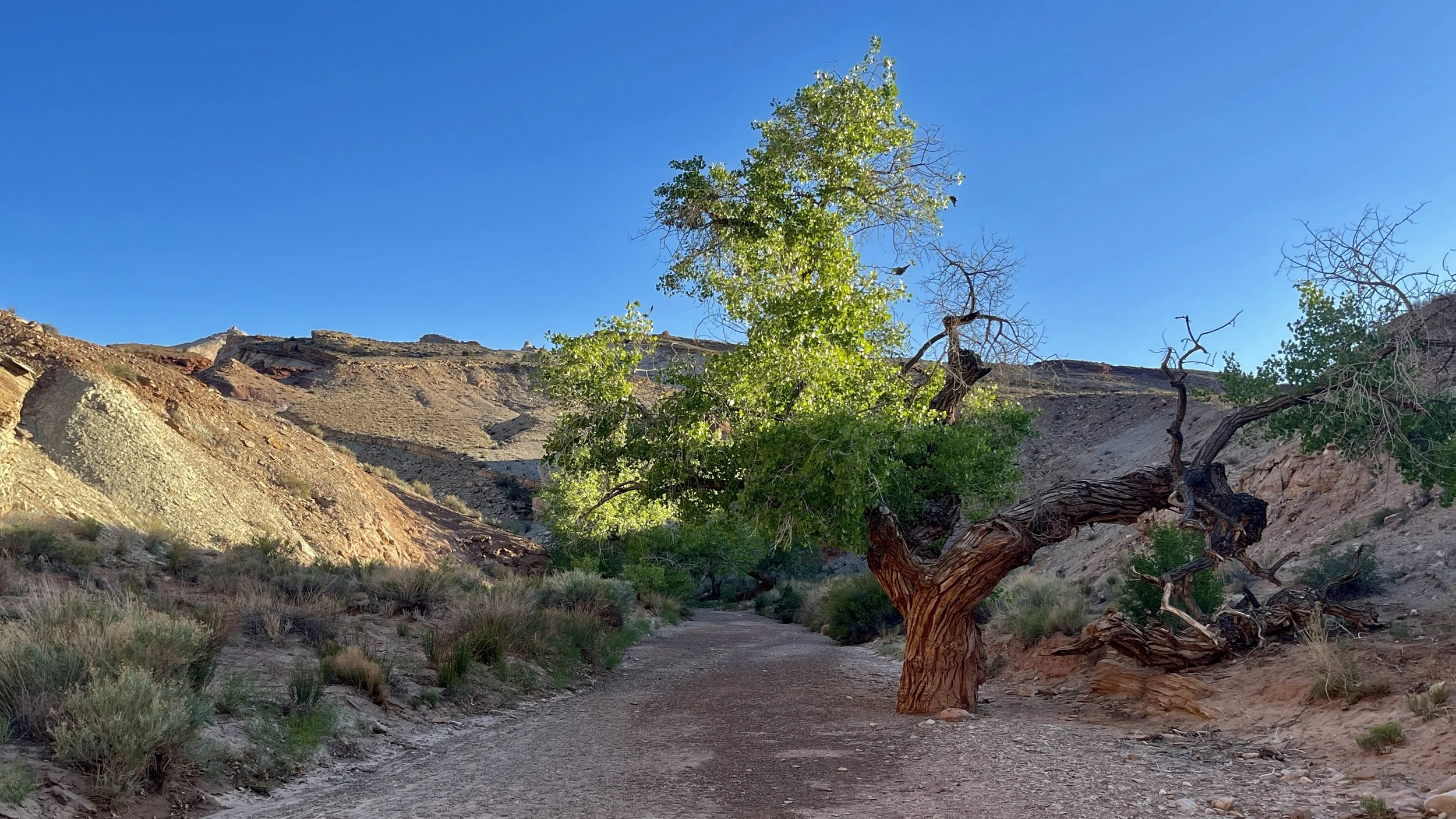
Beautiful tree in the wash near the trailhead for Little Wild Horse Canyon.
This was right near where we had camped back in 1990
The end of the wide wash where the canyon begins
Me at the entrance (Bridgit photo)
Little Wild Horse Canyon
Little Wild Horse Canyon
Little Wild Horse Canyon
Little Wild Horse Canyon
Little Wild Horse Canyon
Little Wild Horse Canyon
Little Wild Horse Canyon
Our turnaround point
As we expected, we ran into a lot of people coming up canyon as we were heading back. By the time we got to the trailhead the parking lot was almost full. Back at camp, Bridgit, who has been battling a pinched nerve in her leg, decided to stay while I went out to do more exploring.
Goblin Valley is such a bizarre and wonderful setting. It consists of a miles long flat valley floor. The valley floor is covered in chocolate colored hoodoos of every shape and size. All along the back of the valley is a long ridge. Cutting into the base of the ridge are numerous small canyons and side valleys. This is where the wildest of the hoodoos live. There are small caves, hills to climb and hidden canyons all over the place. From the main observation area you can go down a set of stairs into what is known as Valley of the Goblins 1. My entire experience in Goblin Valley State Park had all been just checking out the hoodoos in this area. If you hike further south, there is also a Valley of the Goblins 2 and 3. A ranger told me there is even a Valley of the Goblins 4 about four miles south that is really cool but it’s not even on the park map.
I wanted to do something different than what I had seen before so I started at the north end of the parking lot and hiked out a trail that wrapped around to the back side of the ridge to a place called The Goblin’s Lair. I had heard of it before. My understanding was that it was a deep cave and that the only way to get in there was to rappel down into the cave from a hole in the top. Later I read that there is actually a scramble route that though somewhat technical can get you down into The Goblin’s Lair.
The hike was easy and only a 3.4 mile round trip. After wrapping around to the back or east side of the ridge, a very steep but short trail climbed up to the entrance. At the entrance I was looking down into a very deep cavern. I was quite surprised to see several little kids and even two dogs down there. How did they get down there? Rappelling dogs?
The descent down into the Goblin’s Lair was quite vertical and looked very hard but turned out to be considerably easier than it appeared. I’d say it was a medium Class 3 scramble. Once I got down there noticed that there was a climbing rope hanging from up above the cave down to the floor. It turned out that a couple of families were taking turns rappelling down into the cave. I talked with one of the guys. The kids had already done it and now they were waiting for the moms to hike back out to the top and rappel down. The dogs had actually come down the scramble route! I waited around to watch them as they started out with their feet against the wall but soon had to just free rappel down to the floor of the cave. It was pretty cool to watch.
The Goblin’s Lair was a bit too crowded for my liking and I was surprised while I was waiting for the rappellers how many people came down that I never would have guessed would be able to handle the steep rock scramble. But it was a very cool spot.
The final climb to get up to the entrance to The Goblin’s Lair
Looking down into the Goblin’s Lair from the top of the entrance hole
Looking up the scramble route to the very top hole from the floor of the Goblin’s Lair
Holes in the roof of The Goblin’s Lair
One of the moms rappelling down into the Goblin’s Lair
My route to The Goblin’s Lair